
Ground Penetrating Radar Services
What We Offer
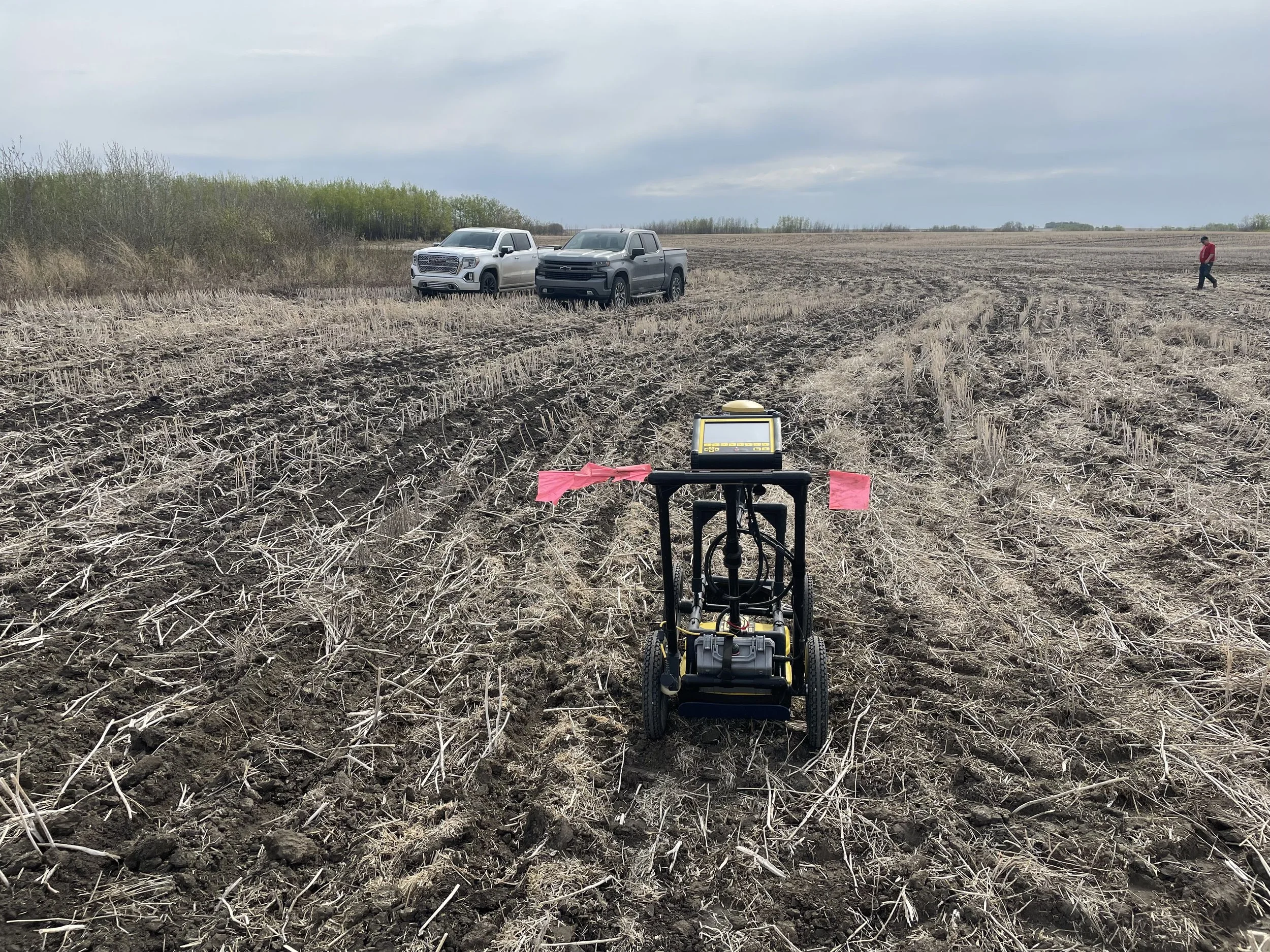
Ground Penetrating Radar (GPR)
Specialized GPR Analysis
For sensitive or complex projects—such as detecting unmarked graves, forensic investigations, or archaeological studies—GPR data is often further analyzed using specialized software like Geolitix Software and EKKO Software. Ground Penetrating Radar is also widely used to:
Identify voids in roadways, highways, and parking lots
Assess landfill contents and buried debris
Measure ice thickness for ice roads
Evaluate resource deposits such as peat layers
Study sediment accumulation in lakes and ponds
We also have access to specialized GPR antennas and equipment to meet the specific requirements of any subsurface investigation project.
Quick, Cost-Effective Surveys
GPR surveys provide a fast, cost-effective, and non-invasive approach for identifying buried objects or voids. They are ideal for:
Property owners and land developers
Urban and rural municipalities
Engineering firms and environmental consultants
Archaeologists and construction companies
Crown corporations and law enforcement agencies such as the RCMP
Our GPR surveys deliver zero ground disturbance, making them a safe and efficient solution for subsurface inspections.
-
Preserving History with GPR
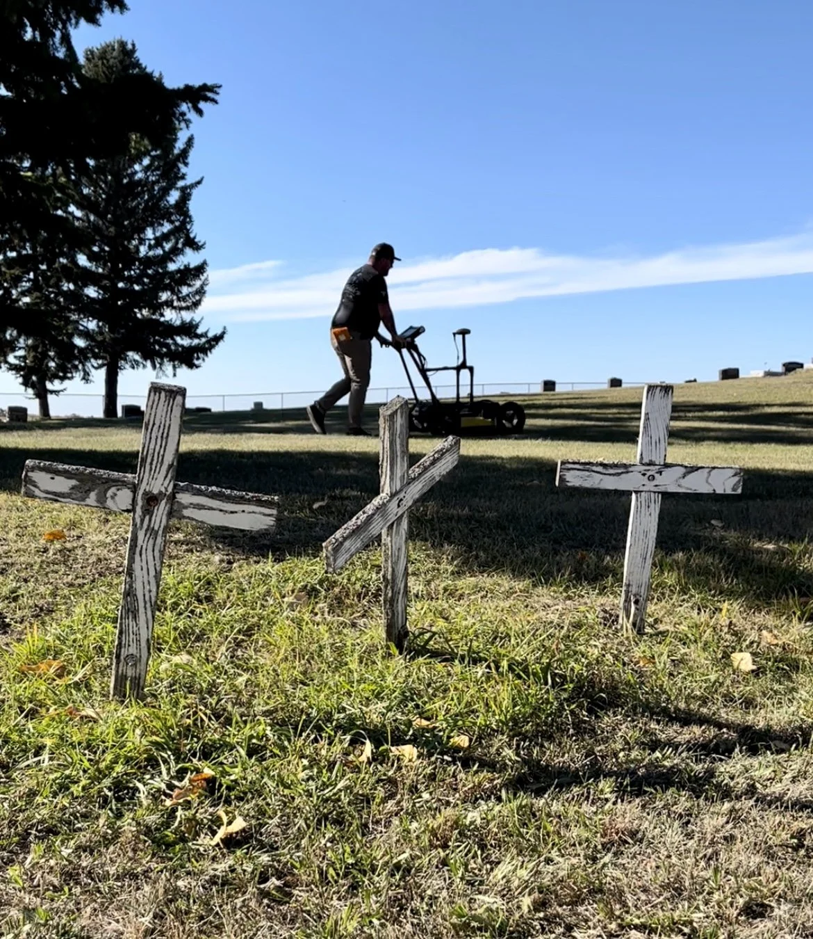
Cemeteries are a vital part of our cultural heritage, and proper cemetery management ensures they are preserved for future generations. Unfortunately, many cemeteries—especially rural sites—lack formal survey plans, accurate burial records, and proper grave markers. Over time, wooden crosses rot, grave markers are moved, and unmarked graves become common.
Identifying Unmarked Graves
We use Ground Penetrating Radar (GPR) to locate unmarked graves in cemeteries across Saskatchewan. Based on over 25 cemetery projects, we have found that all rural cemeteries contain unmarked graves, often making up to 15% of total graves.
Our GPR cemetery surveys help communities, rural municipalities, and church groups:
Preserve historical burial sites
Plan future interments
Ensure proper cemetery management and record-keeping
By combining advanced GPR technology with expert analysis, we provide reliable solutions to locate unmarked graves without disturbing existing sites.
-
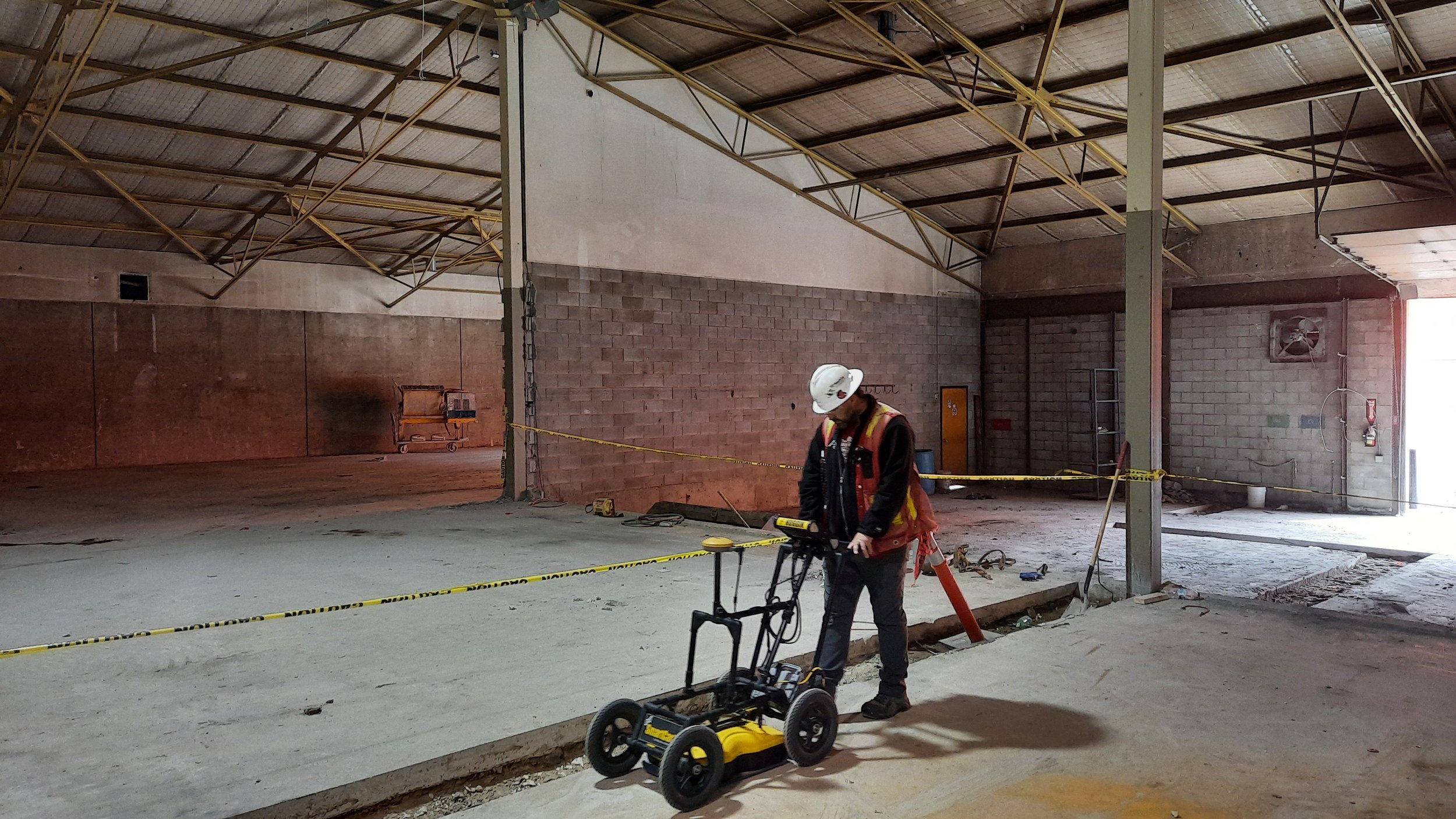
Our Ground Penetrating Radar (GPR) concrete scanning services uses high-accuracy 1000 MHz antenna sensors and advanced imaging software to deliver precise, reliable subsurface detection.
GPR scanning is used to accurately determine the depth and location of embedded objects and utilities within concrete, helping prevent costly damage and safety hazards before coring, cutting, or drilling.
What We Can Detect
Rebar and post-tension cables
Grade beams
In-floor electrical conduit
In-floor heating lines
Slab thickness and depth of concrete
Sub-slab utilities
Potential voids beneath concrete
This non-destructive testing method ensures safe and efficient project planning for commercial, industrial, and residential construction projects.
GPR is highly effective on most concrete surfaces and under ideal conditions can penetrate from 1 inch up to approximately 36 inches deep. However, depth penetration and signal clarity can vary depending on:
Concrete composition
Moisture content
Density
Presence of certain materials such as metal or clay, which may limit signal penetration.
Our experienced technicians interpret scan data carefully to ensure maximum accuracy and reliability.
On-Site Marking & Reporting
All GPR scans include on-site color-coded surface markings , clearly identifying detected utilities and structures unless post-processing documentation is specifically requested.
-
Our GPR void detection services identify hidden air gaps, washouts, and subsurface erosion beneath concrete slabs and structural elements. Using high-frequency Ground Penetrating Radar (GPR) technology, we locate voids before they lead to cracking, settlement, or structural failure.
Void detection is critical for maintaining the safety and integrity of commercial, industrial, and municipal concrete structures.
What Is a Concrete Void? A void is an empty space beneath a concrete slab caused by:
Soil erosion or washout
Poor compaction during construction
Water intrusion
Freeze-thaw cycles
Plumbing leaks beneath the slab
If left undetected, voids can lead to slab settlement, cracking, trip hazards, and structural instability.
Ground Penetrating Radar works by sending high-frequency signals into the concrete and subgrade. When the signal encounters a gap or density change beneath the slab, it reflects back to the system, allowing our technicians to identify:
Air-filled voids
Water-filled voids
Soil separation beneath slabs
Sub-slab erosion
Under ideal conditions, GPR can detect voids from just below the slab surface to depths of approximately 36 inches, depending on soil composition and moisture levels.
Void scanning is commonly used for:
Warehouse and industrial floors
Driveways and parking structures
Sidewalks and walkways
Bridge decks
Loading docks
Concrete pads and foundations
Before performing core drilling, slab stabilization, mudjacking, or polyurethane injection, void detection ensures accurate repair targeting and prevents unnecessary damage.
All detected voids are clearly marked on-site with color-coded layout markings unless detailed digital reporting or post-processing documentation is requested.
-
In complex environments where standard locating methods may struggle, our technology can assist with locating larger or difficult-to-trace utilities.
We can help by:
Identifying large non-conductive utilities
Locating utilities without tracer wires
Detecting soil disturbances from previous installations
Supporting congested underground infrastructure mapping
This layered approach improves accuracy in challenging locating scenarios.
-
We provide Underground Storage Tank (UST) locating services for commercial, industrial, and environmental projects.
Our scanning can help:
Locate buried steel or fiberglass tanks
Estimate tank dimensions
Identify associated piping
Detect ground disturbances indicating prior tank removal
Even if a tank has been removed, subsurface soil anomalies often remain detectable, helping confirm historical site use and supporting environmental due diligence investigations.
-
We provide grade beam locating and depth verification within slabs and below-grade structures.
Our scanning services identify:
Beam locations
Beam width and orientation
Depth below surface
Reinforcement within grade beams
This is essential before trenching, cutting, or structural modifications to prevent accidental damage to load-bearing elements.
-
Our post-tension (PT) cable scanning services identify the exact depth and location of tensioned cables within concrete slabs.
Before coring, cutting, or anchoring into a PT slab, accurate scanning is critical to prevent:
Structural damage
Costly repairs
Safety hazards
Project delays
We clearly mark cable paths and depths on-site to ensure safe drilling and modification of post-tensioned concrete structures.
-
We provide precise concrete and asphalt thickness scanning using non-destructive Ground Penetrating Radar.
Our scanning can determine:
Total slab thickness
Asphalt depth over base
Concrete cover depth
Rebar spacing and depth
Reinforcement layout
This service is ideal for roadwork, structural evaluations, coring preparation, and quality control inspections. Knowing exact slab thickness prevents overcutting and ensures compliance with engineering specifications.
-
Our scanning services can locate buried or abandoned foundations that have been covered by soil, asphalt, or new construction.
We help identify:
Old concrete footings
Foundation walls
Structural remnants
Previously demolished building footprints
This service is especially valuable for redevelopment projects, environmental assessments, and pre-construction planning where undocumented subsurface structures may pose risks.
-
We provide ice thickness testing and structural ice quality assessment for ice roads, winter access routes, and remote industrial crossings.
Using non-destructive scanning methods, we measure:
Ice thickness
Layer consistency
Density variations
Potential weak zones
Accurate ice thickness evaluation is critical for ensuring safe load capacities for transport vehicles, heavy equipment, and resource operations operating in winter environments.
-
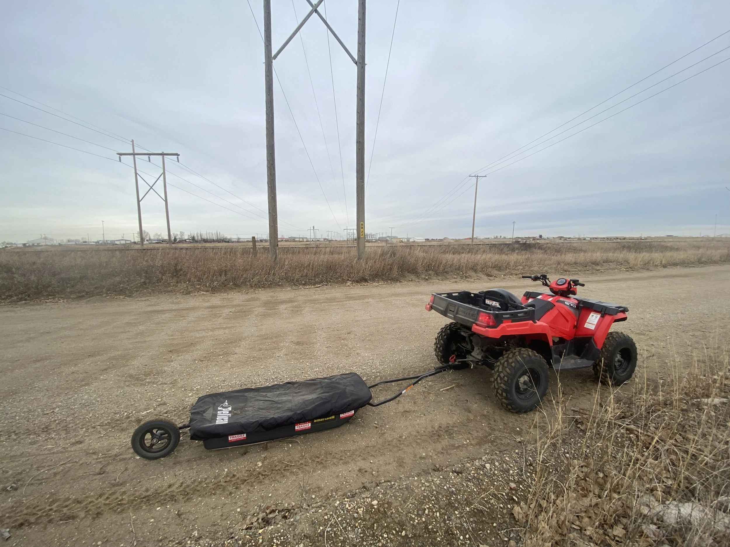
Our GPR gravel pit surveys can be used under the right soil and moisture conditions to help map and estimate subsurface gravel deposits. Using Ground Penetrating Radar technology, we analyze density changes beneath the surface to identify potential aggregate zones.
This service can assist with:
Mapping gravel deposit boundaries
Identifying material depth variations
Supporting excavation planning
Reducing exploratory digging
Because soil composition and moisture content affect signal performance, site conditions are evaluated prior to survey work to determine feasibility and expected accuracy.
Let’s Work TogetherIf you're interested in working with us, complete the form with a few details about your project. We'll review your message and get back to you as soon as possible.